Deadly Storm Spawns Heavy Rain, Floods, and Tornadoes in Michigan, a Sign of Worsening Climate Change
Southern Michigan saw an August record 7 tornadoes from one storm and record-breaking rainfall over two days.
On the night of August 24th, The weather and radar app on my phone gave me an alert. A tornado watch had been issued for parts of southern Michigan northwest of us, east of Lansing. I kept checking it every few minutes. The radar looked progressively more worrisome, with a clear indication of rotation visible even on my small phone screen. A tornado warning popped up a minute later. For the rest of the night, I stayed ready to scoop our toddler out of his crib and hurry to the basement.
The lightning display, though not particularly photogenic, was the most intense I’ve seen in Michigan. I watched the front roll in from our front porch. As it drew nearer, the constant strobe of lightning illuminated the clouds above and beyond a dark, rotating cell. I watched it for a moment until the gust front hit like a plow of cold air, followed by rain flying in sideways. I went inside before I got soaked.
The visuals reminded me of a tornado that jumped over my Illinois high school during a track meet and damaged the local airport just downwind. To see something similar in Michigan, in August, no less, was strange.
As the night unfolded and news reports came in, it was clear that a rotational center nearly missed us, and at least seven tornados touched down, breaking the previous August record in Michigan.
Of the seven twisters, an EF-2 was the most destructive. It roughly followed I-96 from Ingham County into Livingston County before turning southeast. It killed one person and injured three. Semi trailers were flipped along the highway and heavy farm equipment was tossed around like toys.
Tree and structure damage was extensive and widespread across the region. For the third time in as many months. Roof repair companies moved through suburban communities doing unscheduled patch jobs as they went, serenaded by the grumble of generators and chainsaws along the way.
More than 700,000 were without power in Michigan and Ohio after the storms. Thousands were without power even after a week, and that followed a storm the day before that caused outages and a severe storm in late July that left more than 150,000 powerless.
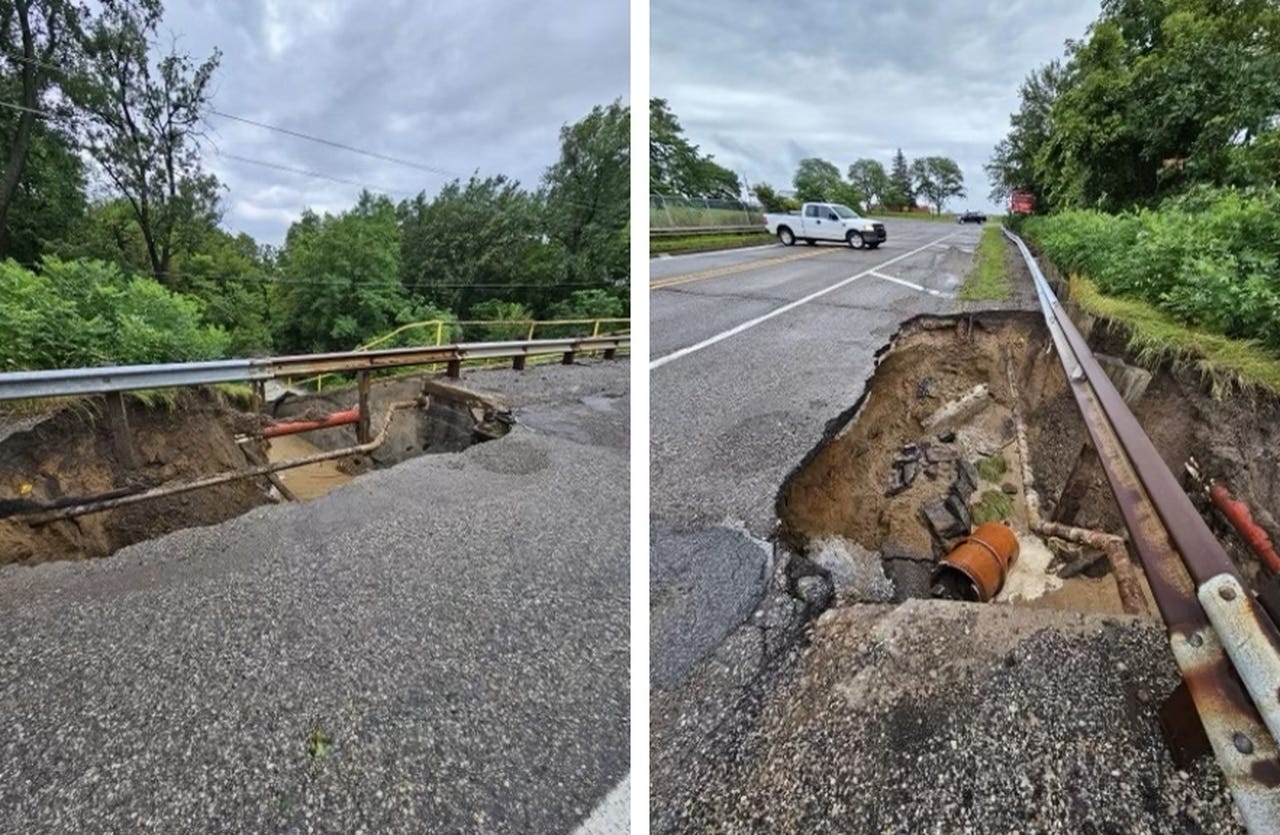
Roughly five inches of rain fell on locations in southeast Michigan on August 23rd. In Washtenaw County, the downstream side of Tyler Dam, which is covered by a roadway, washed out, putting the dam at risk, forcing county water resource and road officials to take immediate action.

Canton, Michigan’s downtown was severely flooded, as were many major roadways around Detroit. Many communities were forced to discharge partially treated and untreated sewage through combined sewer systems to avoid widespread flooding in residents’ homes.
Based on past climate observations, the August 23rd storm would have had a 0.2 chance of occurring in a given year. But the very next night—the tornado night—an even heavier rainstorm flooded the same area. Ypsilanti received almost five inches. Belleville received an eye-popping 7.35 inches. Farther down the Huron River, Rockwood measured 7 inches. Most of that fell within just three of four hours. Based on NOAA’s Atlas-14, that would qualify as a “1000-year storm” on the heels of a “500-year storm.”
At this point, such descriptions of these once very rare storms is silly. Extreme precipitation events now fill rain gauges much more frequently, a clear indication that we don’t live in the climate that we used to. Michigan residents are justified if they feel we are sustaining more tornadoes, floods, and power outages than in the past. Climate change is making those hazards more common.
Increases in flooding and precipitation severity are well-documented. But discussing changes in tornadoes requires more nuance. Tornadoes require several ingredients to come together at the right time in the right way. Having an abundant amount of any one those ingredients, like hot, humid air, won’t make tornadoes more likely if the other ingredients are in short supply. Across the country as a whole, the rate of tornado formation hasn’t changed much even as storms have become more damaging and severe storms have become more likely.
In Michigan, however, we may actually be seeing more of all the necessary conditions. While tornadoes have long been been thought of as a sigil of Great Plains weather, tornadoes have been occurring farther east and slightly farther north. Growing evidence suggests that rising temperatures are giving warmer air masses an additional push from the Gulf of Mexico toward the Great Lakes and the Northeast. Or that larger heat domes in the middle of the country are forcing the jet stream and colliding fronts to different regions than in the past. The latter would explain the atmospheric conditions leading up to the most recent storm.
Regardless, communities across the northern parts of the United States should prepare for more tornadoes and stronger storms. They need to build community awareness, get better warning systems in place, make their electrical grids more resilient, and provide shelter for those who need it.


